
Postcard of the Week: Map of Southern Africa
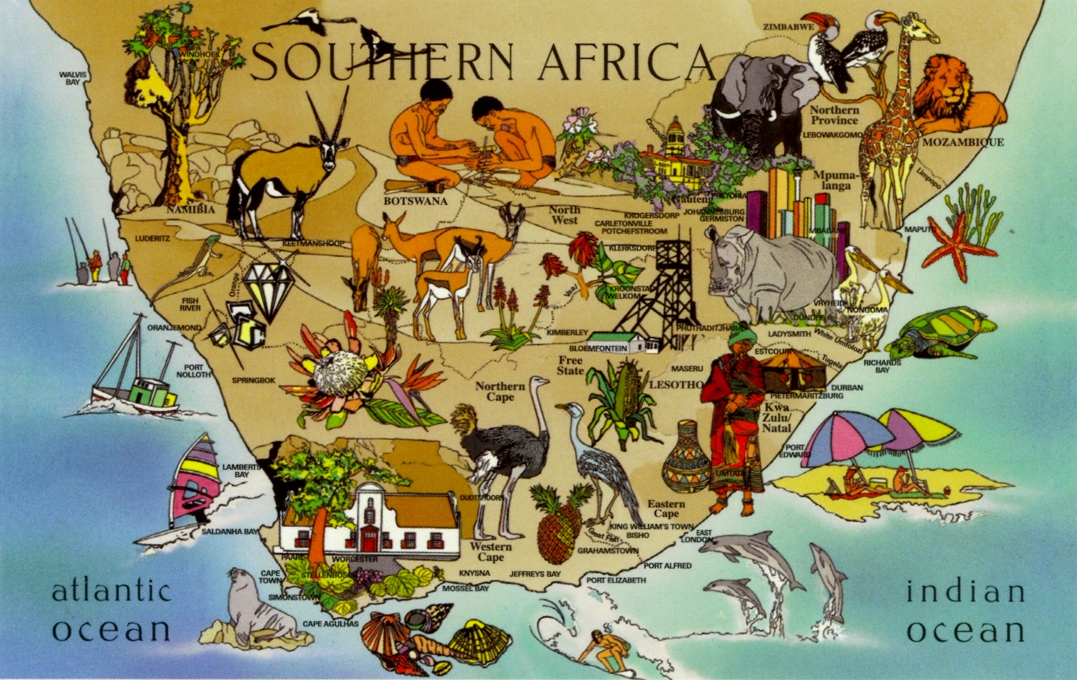
I can’t claim to have been to even a tiny percentage of the area shown on this illustrated map covering Namibia, Botswana, South Africa and Lesotho. I have merely visited Cape Town and Johannesburg. But even in those two developed and westernised cities, I found it to be a land of great contrast, hence why this postcard in particular stuck out to me.
While I’ve only been on safari in Kenya, not in the countries on this map, the ‘Big Five’ remain the same throughout Africa, even if the landscape is vastly different. I have heard from friends who have visited Kruger Park and stayed in a treehouse, and from one friend who even spent three weeks travelling around on safari in a Jeep, sleeping in tents on top of the Jeep! Both trips sounded so intrepid and I’d love to do something similar. We did “walk wild” in Lewa Conservation Park in Kenya for 3 days, involving sleeping in tents in the wild, while protected from lions and other predators by 20 or so local Masaai men, which was a fascinating experience as we learnt so much about tribal culture from spending so much time with them.
What I like most about this postcard is the abundance of nature and the relative lack of human interference, if only the same could be said for some other more developed countries.


Listen to my Podcast


I went on safari in Tanzania and absolutely loved it. I would love to go on another in a different country.
LikeLike
Me too, it’s been years since I was last on safari!
LikeLike
Hi Virginia, would you please allow us to use the Southern Africa Map which had been used as postcard of the week back then. We would like to attach it on a charity’s webpage. Looking forward to hearing from you. Carlos
LikeLike
Yes go ahead, thank you for asking
LikeLike
That’s such a pretty postcard. I really want to go to South Africa now x
LikeLike
I would love to visit Africa someday… hopefully sooner rather than later! Kenya and South Africa are both at the top of my bucket list 🙂
http://www.adelanteblog.com
LikeLike
Your blog is amazing! I love this pc, unfortunately I’ve never been to Africa.
I just started to collect postcards and this is my new blog, if you want you can check it http://postcardlover.blogspot.it/
I can also send a postcard from Italy, just let me know!
Best,
Giuliana
LikeLike
Thanks! And what a cute blog you have! I’m actually coming to Italy in a few weeks to visit Padova – if you’ve been there and can recommend anything then that would be great!
LikeLike