
Postcard of the Week: Easter Island
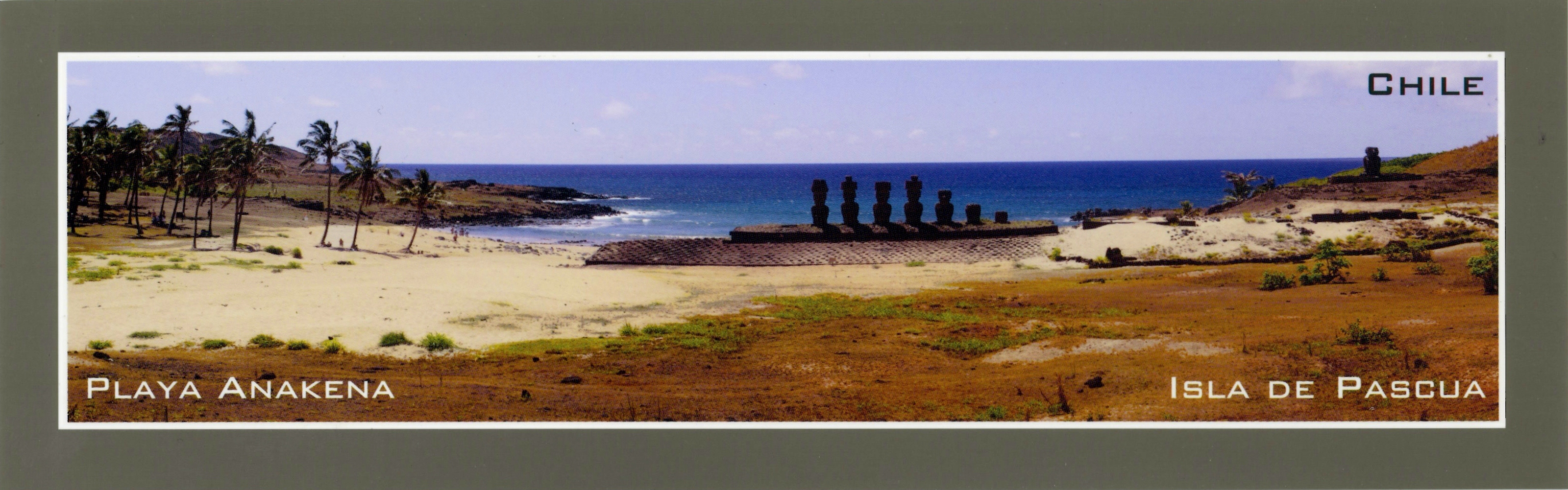 Easter Island, officially part of Chile and sitting in a very isolated part of the Pacific Ocen, has a fascinating past. Most people know of the island only because of the ‘moai’ (the impressive stone heads that decorate the landscape). There are over 900 of them, with the largest figures measuring 10m and upto 150 tons, and it is thought that they are monuments to dead tribal leaders and that they were rolled across the island on thick tree trunks. Easter Island has a rather tragic story – the island was thriving in blissful harmony until the Dutch discovered it on Easter Sunday in 1722 (hence its name). However when Captain James Cook visited the island in 1774 he found an island in ruin, with a population that had shrunk from 20,000 people to just 4,000 in the space of only 52 years. Mass deforestation had caused an ecological imbalance and food shortages, and the inhabitants turned to cannibalism.
Fast forward another 100 years and the Peruvians came to enslave 900 people to work in the fields. Apparently the 15 people that survived & managed to return brought smallpox and other diseases with them and reduced the population further to only 111 people in 1877! The population has now increased again to about 3,800 people but they live a very isolated existence and, understandably, they don’t recognise themselves as Chileans. Sitting in the middle of the ocean around 3,700km away from Chile, I can see why.
The video below is from the Chilean tourist board and their website has all the information you’d need to visit the island.


Listen to my Podcast


1 Comment »